Authors: Fatmah Rashed Mohamed Obaid Alhefeiti, Shaher Bano Mirza
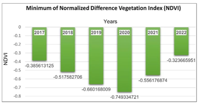
Minimum NDVI values from 2017–2022 showing spatiotemporal changes in vegetation cover across the Emirate of Fujairah using NDVI and GIS analysis.
Abstract: Fujairah is the important emirate of United Arab Emirates with native plants rich is higher nutritional values. These native plants can cope up with harsh conditions of UAE hence are an asset and hold an important interest for the authorities. Monitoring vegetation expansion for plants is essential for the agro-economical values of emirates of Fujairah, UAE. In semi-arid locations, analysis of the dynamics of the vegetation is plays vital role especially given how frequently extended droughts occur. A multi-temporal imagery dataset collected from Sentinel-2 satellite and indexed by NDVI, between January 2017 and August 2022, has been utilized in this study to investigate the dynamics of the vegetation over the Fujairah region.